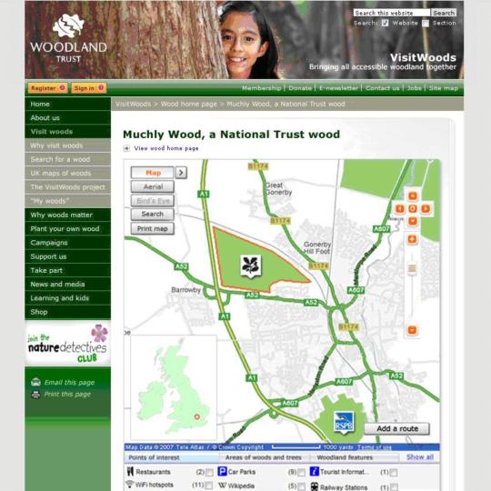
The Woodland Trust has begun a project which will see the overhaul of its interactive woodland mapping system, eventually mapping all of the UK’s 22,000 publicly accessible sections of woodland.
At present, just the 1,000 it owns itself are mapped.
The first part of the project will see the Trust’s existing woodland mapping functionality, which is a bespoke solution provided by a small specialist mapping company, replicated in Microsoft Bing Maps.
The Trust is one of the first to take advantage of licensing changes in Bing Maps, formerly Microsoft Virtual Earth, making the product available for free to charities and non-profit organisations.
Once this has been launched in September, the Trust will start work on ‘VisitWoods’, which will see woodland owned by the National Trust and private landowners included.
New functionality will include aerial photography, pathways, and nearby attractions such as pubs and hotels.
Users will also be able to add their own data for others to view, such as scheduled cycle or walking routes.
“Major players have caught up”
“When we committed to the old system it was the leading edge of where GIS (geographic information system) web technologies were, but the problem is it hasn’t moved on, and the major players have caught up,” said Jon Parsons, digital innovation manager at the Trust.
He added that the project is complicated by the need to provide different complexities of data for different users.
“We go from a map where people are typing in for their nearest wood, to conservation people who want to know whether it has got ancient trees in it, whether it is ancient woodland, and all those types of things."
He added that the Trust had spent around £30,000 over seven years on the old system, but with a specialist development agency it will now be able to get up to the same standard from scratch in six months for £10,000.
According to Parsons, the Trust chose Bing Maps over Google Earth because it was easier to gain an Ordinance Survey license and because the product can talk directly to the Trust’s SQL database rather than having to manually upload data.


